Cinnia · 2026
The trails of the Alpujarra Almeriense, guided from a phone and watched over by the people who walk them
A mobile trail app for the public administration of Almería, Spain: the map of the district, route tracking out in the field, and a channel for hikers to report the real condition of the path.
The challenge
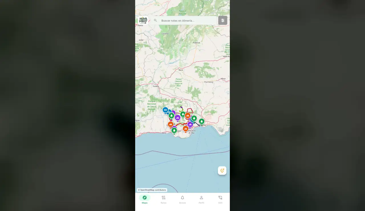
The network of hiking and sport trails in the Alpujarra Almeriense exists on the ground and is signposted, but anyone arriving to walk it had no way to know which routes there are, how long they run, how much they climb, or whether a path is passable today. And the administration that maintains it had no route by which to hear about a problem on a trail until someone reported it on their own initiative.
The solution
An app with the map of the province and the signposted routes on it, a catalogue giving each route's difficulty, distance, duration and elevation gain, node-by-node tracking while walking, and a reports section where anyone can flag what they run into — a blocked trailhead, a stretch that smells, a fallen sign — with a photo and a location, visible on the map for everyone else.
Our approach
We built it together with Cinnia, who won the public tender with the administration. The decision that ordered everything else was to assume the app gets used in the field and not on a sofa: tracking keeps running in the background with the screen off, a report is written from the trail itself, and SOS sits one tap away on every screen rather than buried in a setting.
Impact
- The network's routes live in a single catalogue, with difficulty, distance, duration and elevation gain available before leaving home.
- The trail is followed node by node, and tracking does not stop when the screen goes dark.
- The real condition of the path is reported by the people walking it, with photo and location, and reaches whoever maintains it.
- SOS holds a fixed place in the bottom bar: it is equally close from any screen in the app.
Verified figures for this project are pending publication.
Technology
- Flutter
RETURAL is the network of hiking and sport resources of the Alpujarra Almeriense, in the province of Almería, Spain. The work went out to public tender and Cinnia won it; we joined their development team rather than sitting next to it as a separate supplier. It is how we prefer to work when the end client is a public administration: one chain of responsibility all the way to the product, with no apportioning of blame waiting for the first failure up in the hills.
Related work
-
 A single query for environmental data scattered across six institutions A platform that consolidates public environmental and geological data from multiple Colombian institutions into one searchable, purchasable dataset. View the case
 -
 Three business lines, two countries, one quoting channel A bilingual corporate platform for an industrial supplier that sells spare parts, surplus inventory and heavy-transport components across the Americas. View the case
Have a technology challenge in mind?
Tell us what you are trying to solve. We will help you find the right path — and if there isn't one, we will say so.
Let's talk